 NIB - MORSKA BIOLOŠKA POSTAJA PIRAN
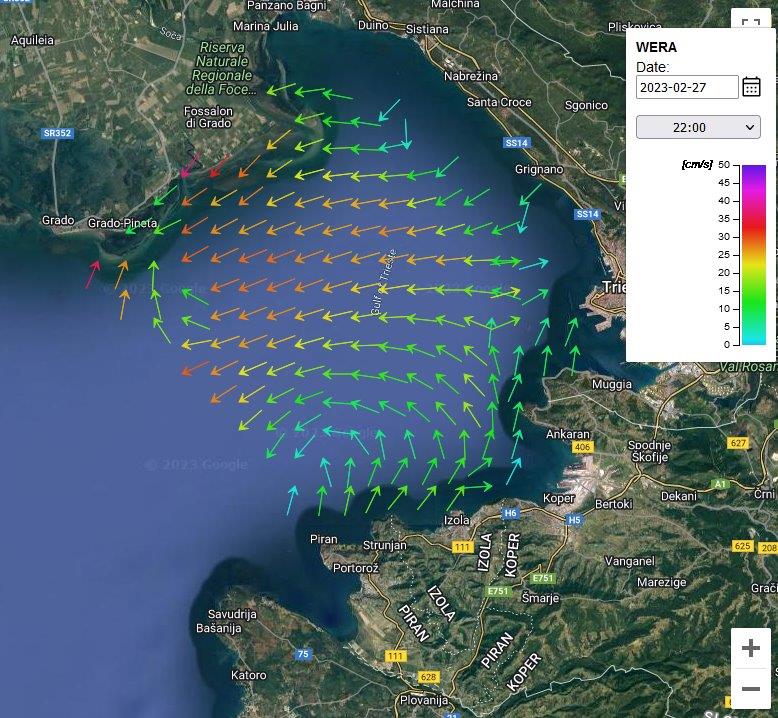
HF radar system in the Gulf of Trieste (GOT)
HF radar systems measure the speed and direction of surface and ocean currents in near real time (displayed in UTC with an additional delay of up to 1 hour). Ocean currents are the equivalent of winds in the atmosphere as they move things from one place to another. These currents carry pollution with them and it is therefore important to understand currents from both an environmental and economic perspective. Currents transport navigable objects, so this information is used by rescuers to make decisions during search and rescue operations at sea. HF radars can measure currents over large areas of sea or ocean and are therefore deployed at high-altitude locations along the coast.
The complete HF radar network in the Gulf of Trieste consists of 4 HF radar nodes: Besides the HF radar node above Izola, managed by the National Institute of Biology (NIB), the system also consists of a HF radar node in Piran, managed by the Slovenian Environmental Agency (ARSO), the HF node in Aurisina-Italy, managed by the Istituto Nazionale di Oceanografia e di Geofisica Sperimentale (OGS), and a HF radar node off Trieste, managed by Agenzia Regionale per la Protezione dell’Ambiente del Friuli Venezia Giulia (ARPA). The results of the measurements from all 4 radars are combined into a single vector representation of the currents in the Gulf of Trieste. Finally, the results of the measurements are an excellent check of the model predictions that can be fed from them.
The HF radar node installed in the parking lot on the slope below the Izola Hospital in June 2022 by the National Institute of Biology, Marine Biological Station (MBP), was co-funded by the international INTERREG MED project “SHAREMED”.
The setup of the HF radar was enabled by the SHAREMED ![]()

 |
 |
 |
 |